Services
Business Advertising
- Ground and Aerial Pictures $200
- Virtual Tour Support and Set-Up $100
- Content Creation Starting at $500
- Event Capture - Call Us For A Quote!

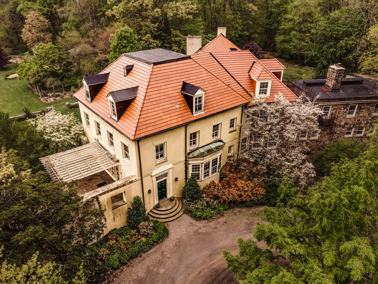
Real Estate Photography
The real estate market has wholeheartedly welcomed drone technology. It has been one of the most valuable assets to the industry. Real estate drone photography uses drones to capture photos and videos of properties from an aerial view. With this, the real estate sector has become more imaginative and touched the technological realms to new heights. This modernized conventional aerial photography technique boosts your listing quality and focuses on presenting creativity in your listings.
Real Estate Ground Picture Pricing:
- Up to 2000 sq. ft. $100
- 2000-3000 sq. ft. $125
- 3000-4000 sq. ft. $150
- 4000-5000 sq. ft. $200
- 5000-6000 sq. ft. $250
- Custom quote over 6000 sq. ft.
Drone Aerial Pictures add-on $100
Twilight Picture $20 per.
Virtual Tour Set-Up and Support
- Up to 2000 sq. ft. $100
- 2000-4000 sq. ft. $200
- 4000-6000 sq. ft. $300
Video Tour $200
Mini-Doc Property Showcase $500
Photography & Videography
Capture every moment—on the ground and from the sky.
At Milan Production, we offer comprehensive photography and videography services that bring your vision to life through both ground-based and aerial perspectives. Whether you’re planning a wedding, hosting a live event, or need high-impact content for social media, we deliver stunning visuals that tell your story with clarity and style.
Our services focus on capturing the rich details, emotions, and atmosphere of your moments. Using professional-grade cameras, stabilizers, state-of-the-art drone technology, and cinematic techniques, we produce high-quality photos and videos.
Our Services Include:
-
Weddings & Engagements
Elegant, emotional, and cinematic coverage of your special day—from the ceremony to the celebration, including aerial venue shots. -
Events & Live Performances
From corporate functions to concerts and festivals, we capture the energy, moments, and atmosphere with dynamic photo and video coverage. -
Portrait & Lifestyle Sessions
Individual, couple, family, or branding portraits with natural light or studio-style setups—on location or at your favorite spot. -
Social Media Content Creation
Short-form videos, reels, and creative imagery tailored for Instagram, TikTok, YouTube, and beyond. -
Aerial Drone Photography & Video
Licensed and insured drone services for breathtaking overhead views of events, properties, venues, or marketing content. -
Real Estate & Business Showcases
Professional walkthroughs, highlight reels, and stills that showcase your space in the best light—inside and out.
Why Choose Us?
-
High-resolution photo and 4K+ video quality
-
Fully licensed and insured drone operation
-
Fast turnaround with expert editing
-
Custom packages for every type of project
Whether it’s an intimate portrait session or a large-scale event, we’re here to help you create unforgettable visuals—both from the ground and above.
📞 Let’s talk about your vision. Contact us today to get started or request a quote.

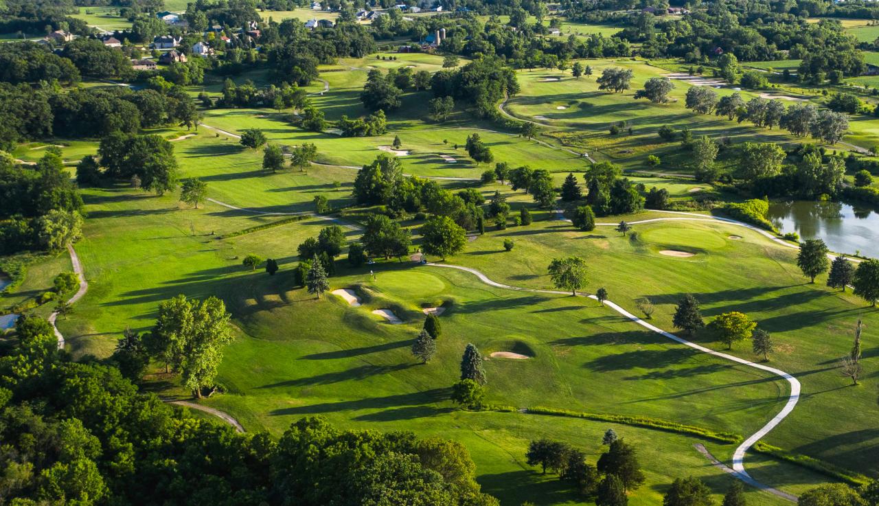
Golf Course Fly-over
Call us today for a quote!
Aerial Inspections
Drone Inspections can dramatically reduce the high costs, safety risks, and time involved with conventional inspection methods. Since drones are small and inexpensive to operate, you can carry out more inspections every month than you can with conventional methods, without shutting down operations and affecting production. In traditional methods, you need to schedule a shutdown and assemble several workers, vehicles, helicopters, and other inspection equipment, especially for the energy sector. Also, the mobility, speed, ease of use, and efficiency of drones provides companies with the opportunity to collect data on a large scale.
Drone-based field investigations provide invaluable information to operational and maintenance managers with the following added advantages:
- Enhanced Safety
-
Reduced Need for Temporary Structures
-
Lower Maintenance Costs
-
Minimized Downtime
-
Reduced Liability Insurance Costs
-
Increased Inspection Frequency
- Save Lives!

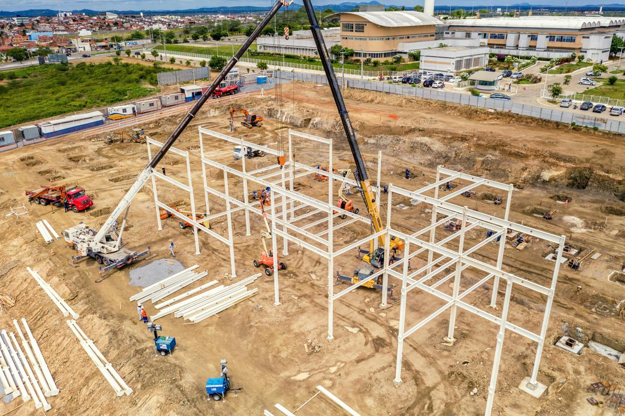
Construction Progress Monitoring
Historically, most aerial views of construction sites were obtained through helicopter photography. This method has proven to be time-consuming, expensive, and inefficient, and as a result, the use of unmanned aerial vehicles (UAVs), or drones, is rapidly gaining popularity as a highly-effective alternative method of construction monitoring.
Drones controlled by an experienced pilot can be flown high above the job site, sending real-time information to the engineers and project managers on the ground. At the same time, UAVs collect high-resolution images that can then be used by licensed surveyors and mappers to create 3D models. Crucially, drones can fly close to the construction area, providing close-up shots of multiple areas around the jobsite.